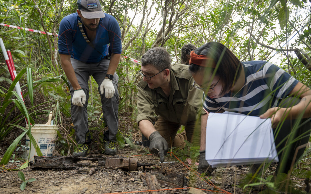
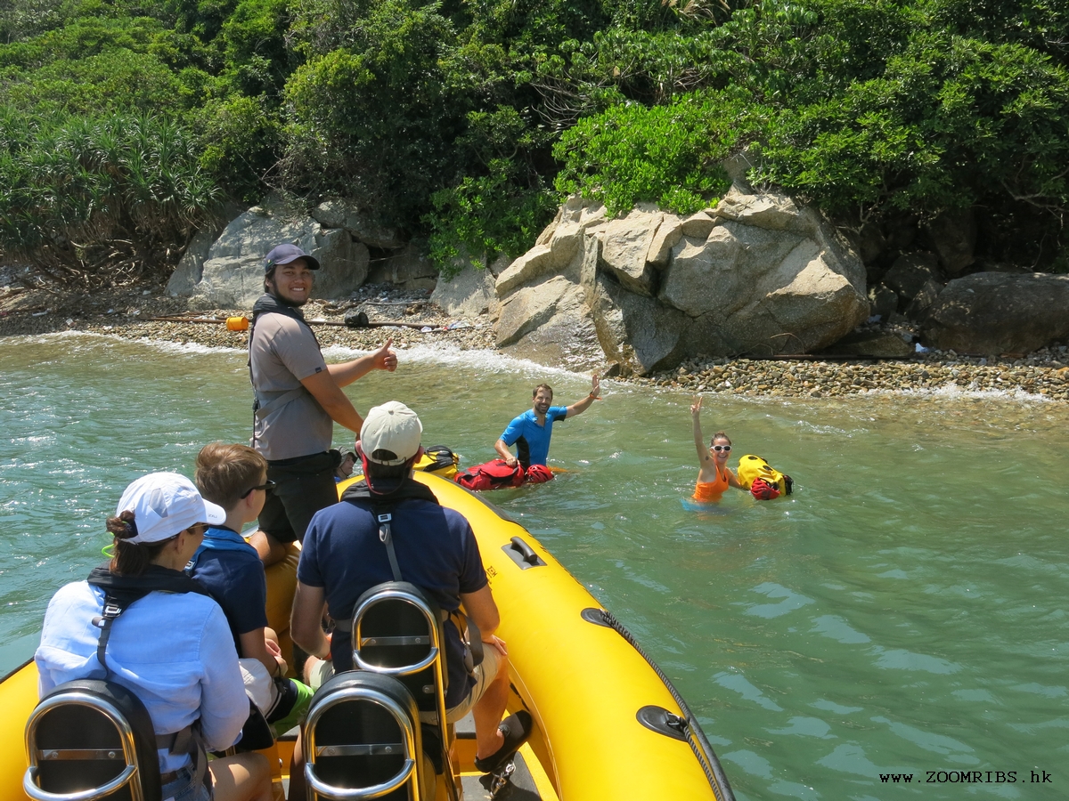
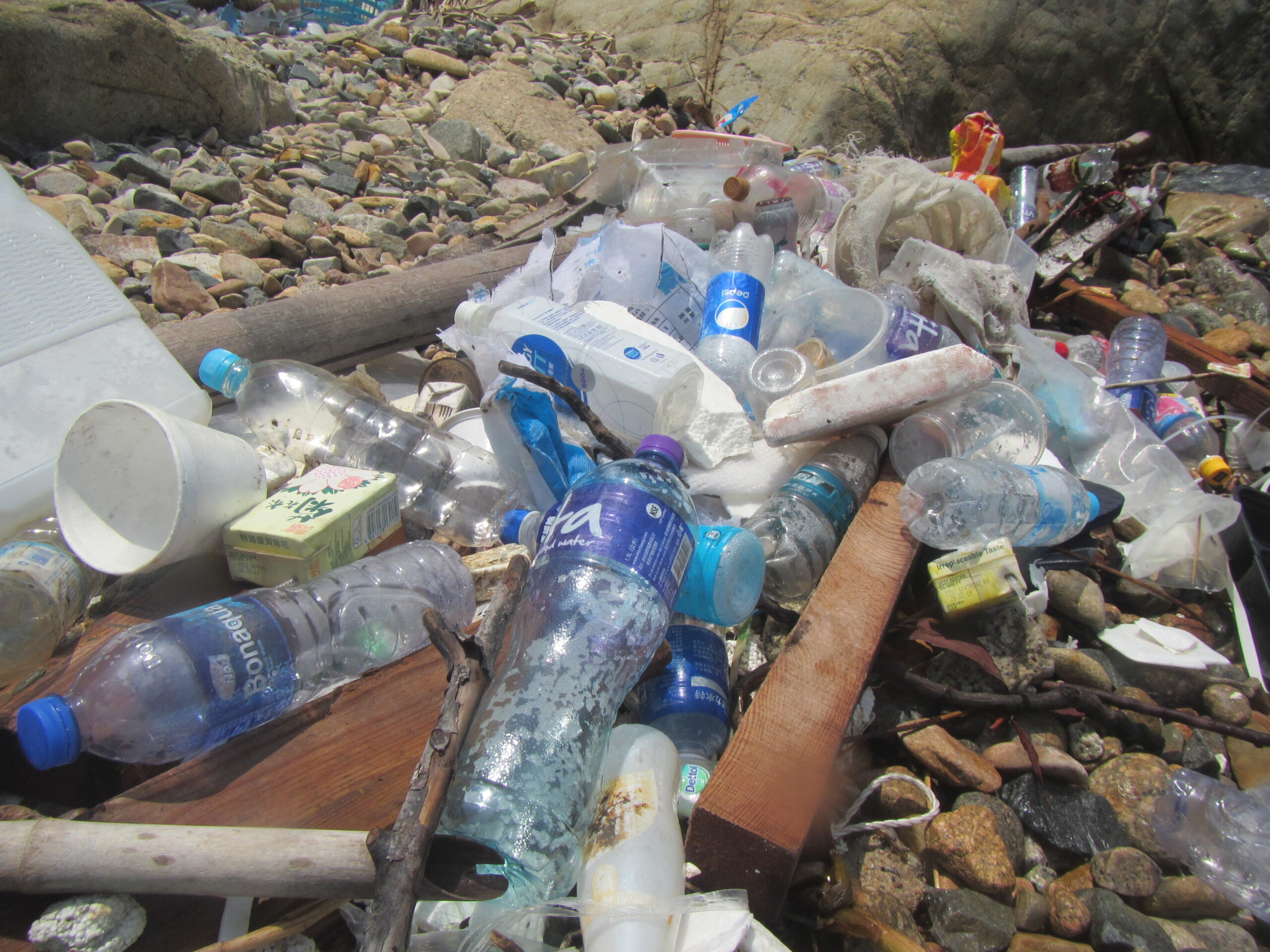
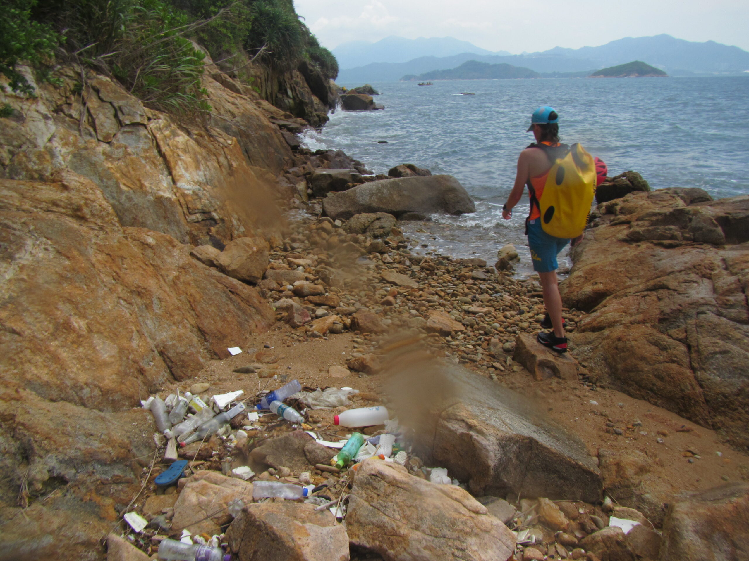
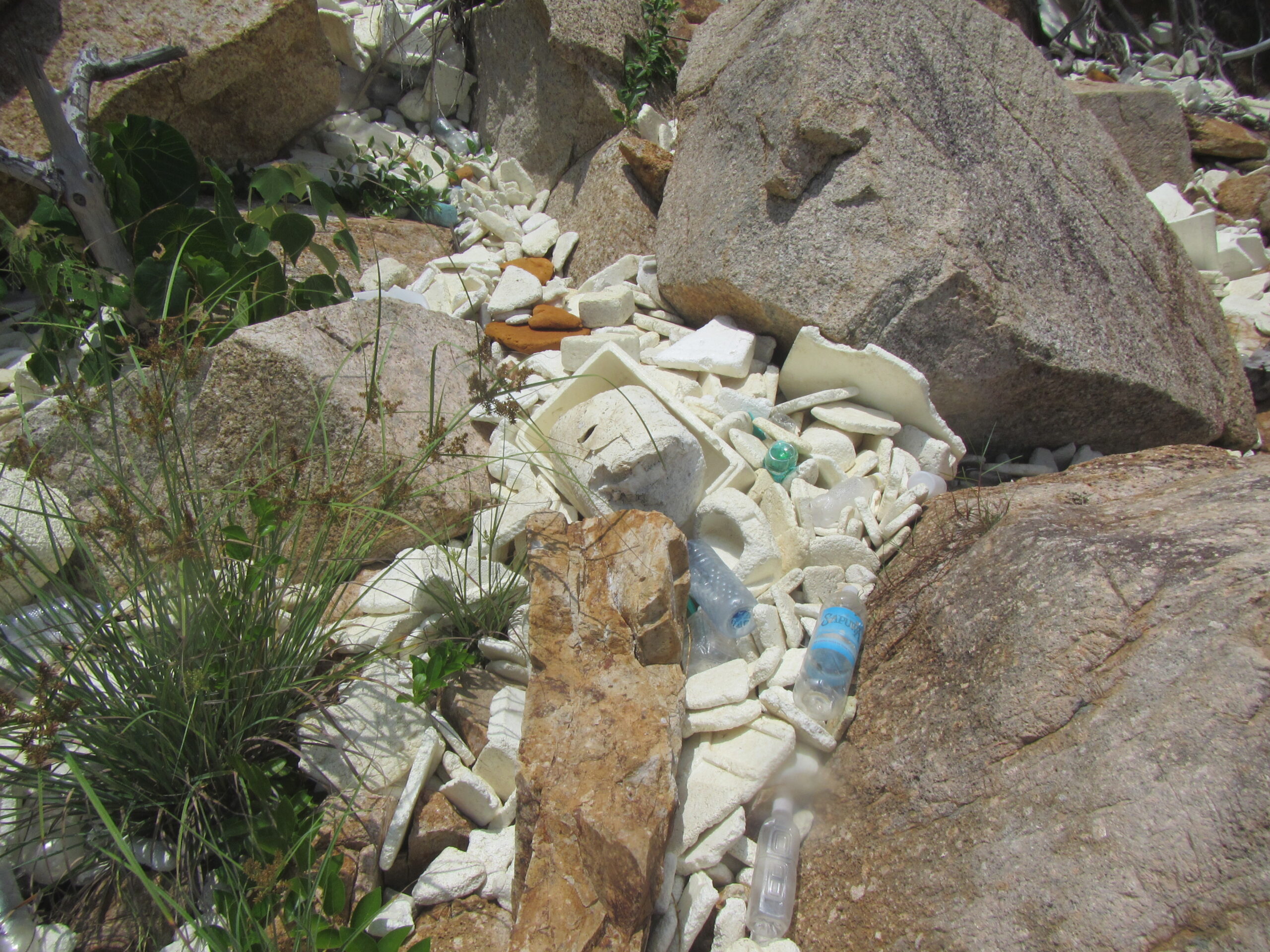
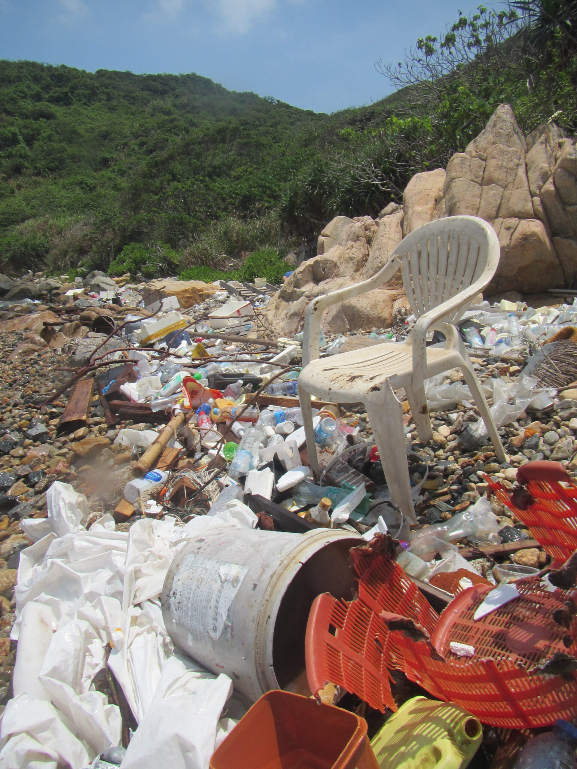
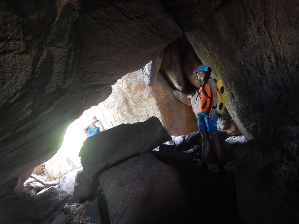
The howling of the engine was overshadowing everything as Kevin pressed the throttle down – we were speeding with 30knots + towards the Hong Kong harbour. The owner of HK operation Zoomribs had kindly agreed to give us a lift to the tiny island of Kau Yi Chau, thats located between Hong Kong and Lantau Island. Usually only exposed to a random blink of an eye for the commuters on the Macao ferry it has recently gained notoriety as doomed for extinction. Kau Yi Chai is part of proposed East Lantau Metropolis project and runs the risk to soon vanish. Hong Kongs skyline is clearly visible but its nevertheless the small island has more of a Robinson Crusoe feel. The absence of a jetty (despite a radar station being prominently located on the island) requires us to jump overboard and swim the last metres. Our mission: To coasteer the island and map its coastal pollution (i.e. a “Mini Round the Island Adventure”) It should turn into quite an adventure: “I pick you up in three hours – be on time!” Kevin shouted towards us. Having dropped us off on the north shore of the island he sped off to Lantau for a lunch. “No worries, we probably can do laps, shouldn’t take us more than an hour to go around” – that was Colin’s comment. Colin, Hong Kong’s adventure guru and probably most experienced coasteerer had joined us for todays outing and was also in for a rare first: he had also never been on the island before. It all started with some big boulders- nothing too difficult, but the coastal rocks proved technical enough to keep our progress slow. On some of the beaches we started to find washed up plastic pollution, also significant amount of plastic bottles. The difficulties increased once we reached the southern shores of the island. Colin tried a few boulders around Kau Yi Chau cave, but it proved tricky. Time was passing by and we were already quite significantly past the hour mark. After every bay seemed to be another bay. Boat swell from Macao ferries also made our progress more difficult. We soon had to realise that the 3 hour mark might even get quite close. Finally the big boulder – clearly visile from the passing ferries came into view. But crossing the bay towards it was a depressing sight – heaps and heaps of trash – chairs, bottles, fishnets etc… some of it resting for sure for years, some of it recently washed up. The boulder was massive, underneath a big cave – an ideal pirates hideout. What kind of stories played out here? We finally had reached the eastern beacon. Our final waypoint our coasteer of the island. The final surprise: the rocks were to steep, no chance to climb it. We had to swim. Only then we realised that the swell had picked up, proper swell pounding the only slightly submerged rocks full of barnacles. But there was not other option – we jumped into the sea and had to quickly realise that it will be difficult to get out again. We swam on, but a magnet was pulling us back. Strong currents were pulling us back, hence our way around the beacon was barred. We need to go through the rock maze despite the waves.
One by one we jumped, using our rope to make a secure handline. Smart thinking as a wave took out Esther and was about to see-saw her over the Barnacles.. Exhausted we made it back to the beach were we saw already our yellow Rib waiting for us. A touch more than three hours. So much for a walk in the park. Our results: We mapped in total 18pollution sites, tons of old styrofoam (partially decomposted) and especially on the souteastern bay a lot of recently washed up trash (Plastic Bottles etc.) Special thanks to Zoomribs and Kevin for giving us a lift to the island.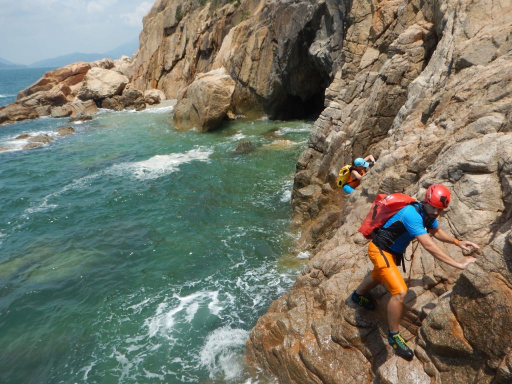
The curse of the mosquito (or being caught out by climate change)
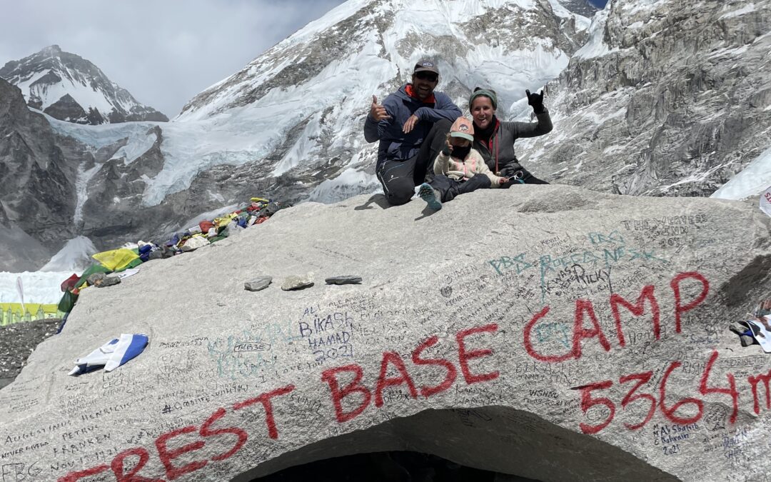
The plan was straightforward: Pack bags, travel to remote valley, hike to virgin peak. Climb! So was the plan for my recent expedition into the remote Naar-Phu valley in Nepal, which came together...